Start here
Introduction to Sky Map 2000
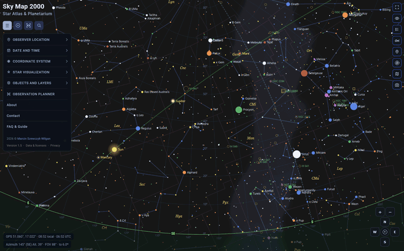
Sky Map 2000 is a browser-based star atlas and planetarium for learning the sky, finding objects and preparing an observing session. It aims to make a busy sky easier to read, without pretending the screen can replace the experience of observing the real night sky.
What it is for
The map brings together an observer’s location, a chosen date and time, and a set of astronomical catalogues. In Horizontal mode it presents the sky in relation to your selected horizon, and it answers the everyday questions: what is above me now, which way should I look, is a planet high enough to bother setting up for.
An Equatorial view is a switch away. It uses right ascension and declination, the fixed grid found in traditional star atlases and telescope references. Both views describe the same sky from a different useful angle.
Three questions to begin with
- Where are you? Choose a city, enter coordinates or allow your browser to use device location. Your position sets the local horizon and the altitude of every object.
- When are you looking? Use the current time, pick another date or run a time-lapse. Stars appear to move as Earth rotates; the Moon and planets also shift against the background sky.
- What are you trying to see? Turn on the layers that help, search for an object, or open the observation planner for a short, location-aware starting list.
Who it is for
Sky Map 2000 was written for curious beginners, amateur astronomers, teachers, and anyone who wants a fast reference for the night sky. No account, no install, no special equipment. A phone, tablet or desktop browser is enough for orientation; binoculars or a telescope open up many more targets but are not required to learn from the map.
What the map is based on
The star layer holds more than 99,000 records to apparent magnitude 9.5, drawn from HYG Database v44. Deep-sky objects come from selected Messier and NGC/IC entries in OpenNGC. Constellation lines, boundaries and labels use d3-celestial data. Positions of the Sun, Moon and planets are computed locally in your browser from low-precision orbital elements.
That combination makes the app well suited to orientation, teaching and everyday planning, and keeps it honest about scope: it is a reference and a teaching tool, not a high-precision ephemeris service, telescope-control software or a source for safety-critical decisions.
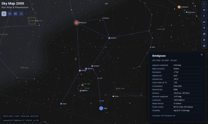
To turn that context into a working observing view, continue with observer location, date and time and map controls and tools.
Your location stays in your browser
When you pick a city, type coordinates or use device location, the app uses that information locally to compute the view. Your last deliberate choice can be kept in browser storage so a later visit starts where you left off. The city catalogue is bundled with the application; the names you type are not sent to a location-search service.
Sources and editorial approach
Catalogues: HYG Database v44, OpenNGC and d3-celestial.
Planet reference values: NASA/JPL Planetary Physical Parameters.
Documentation: written and maintained with the application by Marcin Szewczyk-Wilgan. Descriptions of controls, cards and calculations follow the behaviour of the current build of Sky Map 2000.